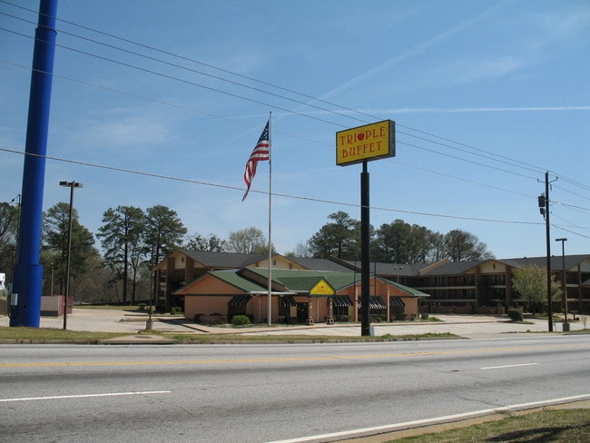
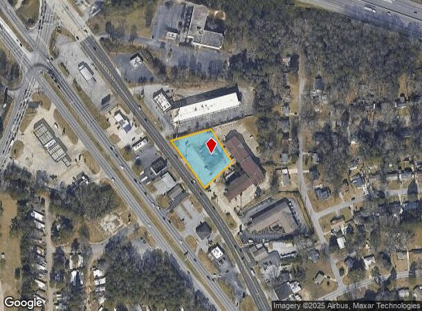
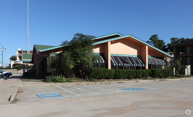
Property Record
6340 Old Dixie Hwy, Jonesboro, GA 30236

NEARBY LISTINGS FOR SALE OR LEASE
Property Detail
6340 Old Dixie Hwy
13-0142B-00C-002
Clayton
Restaurantbuilding
Georgia
X
142
13063C0059F
0.96 AC
2025
Riverdale/Jonesboro
2025
Atlanta
040414
Atlanta-Sandy Springs-Roswell, GA
5,317 SF
DEMOGRAPHICS near 6340 Old Dixie Hwy
1 Mile
3 Mile
5 Mile
2024 Total Population
12,364
81,665
193,801
2029 Population
12,289
81,579
193,144
Pop Growth 2024-2029
(0.61%)
(0.11%)
(0.34%)
Average Age
32
35
35
2024 Total Households
4,316
30,666
70,638
HH Growth 2024-2029
(0.63%)
+ 0.03%
(0.31%)
Median Household Inc
$41,515
$43,451
$45,653
Avg Household Size
2.80
2.60
2.70
2024 Avg HH Vehicles
2.00
2.00
2.00
Median Home Value
$98,272
$139,289
$154,739
Median Year Built
1976
1980
1981
Nearby Places
Map Layers
Map Styles
 Street
 Aerial
- Restaurants
- Banks
- Shops
- Fitness
- Groceries
PUBLIC TRANSPORTATION
AIRPORT
Hartsfield - Jackson Atlanta International
DRIVE
WALK
Distance
Hartsfield - Jackson Atlanta International
12 min
6.8 mi
SALE & LEASE HISTORY
LISTING DATE
SALE/LEASE

Sep 25, 2016
For Lease
Mar 15, 2019
For Sale
Feb 20, 2019
For Lease
Feb 06, 2017
For Sale
Nearby Properties
Address
Land Use
TOTAL SIZE
Lot Size
Zoning
Address
Land Use
TOTAL SIZE
Lot Size
Zoning
518,648 SF
31.03 AC
MCD
Address
Land Use
TOTAL SIZE
Lot Size
Zoning
596 SF
57.40 AC
RM
Address
Land Use
TOTAL SIZE
Lot Size
Zoning
324 SF
49.49 AC
RM
Address
Land Use
TOTAL SIZE
Lot Size
Zoning
11.31 AC
RM
Address
Land Use
TOTAL SIZE
Lot Size
Zoning
250 SF
31.25 AC
RM
Address
Land Use
TOTAL SIZE
Lot Size
Zoning
200 SF
23.02 AC
RM
Address
Land Use
TOTAL SIZE
Lot Size
Zoning
230 SF
27.09 AC
RM
Address
Land Use
TOTAL SIZE
Lot Size
Zoning
370 SF
36.20 AC
RM
Address
Land Use
TOTAL SIZE
Lot Size
Zoning
200,370 SF
23.81 AC
C
Address
Land Use
TOTAL SIZE
Lot Size
Zoning
264 SF
24.92 AC
RM
Address
Land Use
TOTAL SIZE
Lot Size
Zoning
351,207 SF
20 AC
HI
Address
Land Use
TOTAL SIZE
Lot Size
Zoning
105,260 SF
12.67 AC
C
Address
Land Use
TOTAL SIZE
Lot Size
Zoning
316 SF
34.30 AC
RG75
Address
Land Use
TOTAL SIZE
Lot Size
Zoning
212,048 SF
110.06 AC
HI
Address
Land Use
TOTAL SIZE
Lot Size
Zoning
387 SF
32.53 AC
RM
Address
Land Use
TOTAL SIZE
Lot Size
Zoning
96,028 SF
21.02 AC
I
Address
Land Use
TOTAL SIZE
Lot Size
Zoning
252 SF
27.14 AC
RM
Address
Land Use
TOTAL SIZE
Lot Size
Zoning
308,683 SF
41.30 AC
C
Address
Land Use
TOTAL SIZE
Lot Size
Zoning
216 SF
24.45 AC
RM
Address
Land Use
TOTAL SIZE
Lot Size
Zoning
200 SF
20.23 AC
RM
Address
Land Use
TOTAL SIZE
Lot Size
Zoning
200 SF
20.71 AC
RM
Address
Land Use
TOTAL SIZE
Lot Size
Zoning
190 SF
21.66 AC
RM
Address
Land Use
TOTAL SIZE
Lot Size
Zoning
410 SF
35 AC
RM
Address
Land Use
TOTAL SIZE
Lot Size
Zoning
167,008 SF
36.21 AC
HI
Address
Land Use
TOTAL SIZE
Lot Size
Zoning
252 SF
23.62 AC
RM
Address
Land Use
TOTAL SIZE
Lot Size
Zoning
240 SF
28.43 AC
RM
Address
Land Use
TOTAL SIZE
Lot Size
Zoning
422,480 SF
19.42 AC
HI
Address
Land Use
TOTAL SIZE
Lot Size
Zoning
240 SF
27 AC
HI
Address
Land Use
TOTAL SIZE
Lot Size
Zoning
198 SF
32.10 AC
RM
Address
Land Use
TOTAL SIZE
Lot Size
Zoning
250,048 SF
31.80 AC
HI
The World's #1 Commercial Real Estate Marketplace
Connect with us
© 2025 CoStar Group
The information above has been obtained from sources believed reliable. While we do not doubt its accuracy we have not verified it and make no guarantee, warranty or representation about it. It is your responsibility to independently confirm its accuracy and completeness. Any projections, opinions, assumptions, or estimates used are for example only and do not represent the current or future performance of the property. The value of this transaction to you depends on tax and other factors which should be evaluated by your tax, financial, and legal advisors. You and your advisors should conduct a careful, independent investigation of the property to determine to your satisfaction the suitability of the property for your needs.